Grand Tetons / portfolio
About:
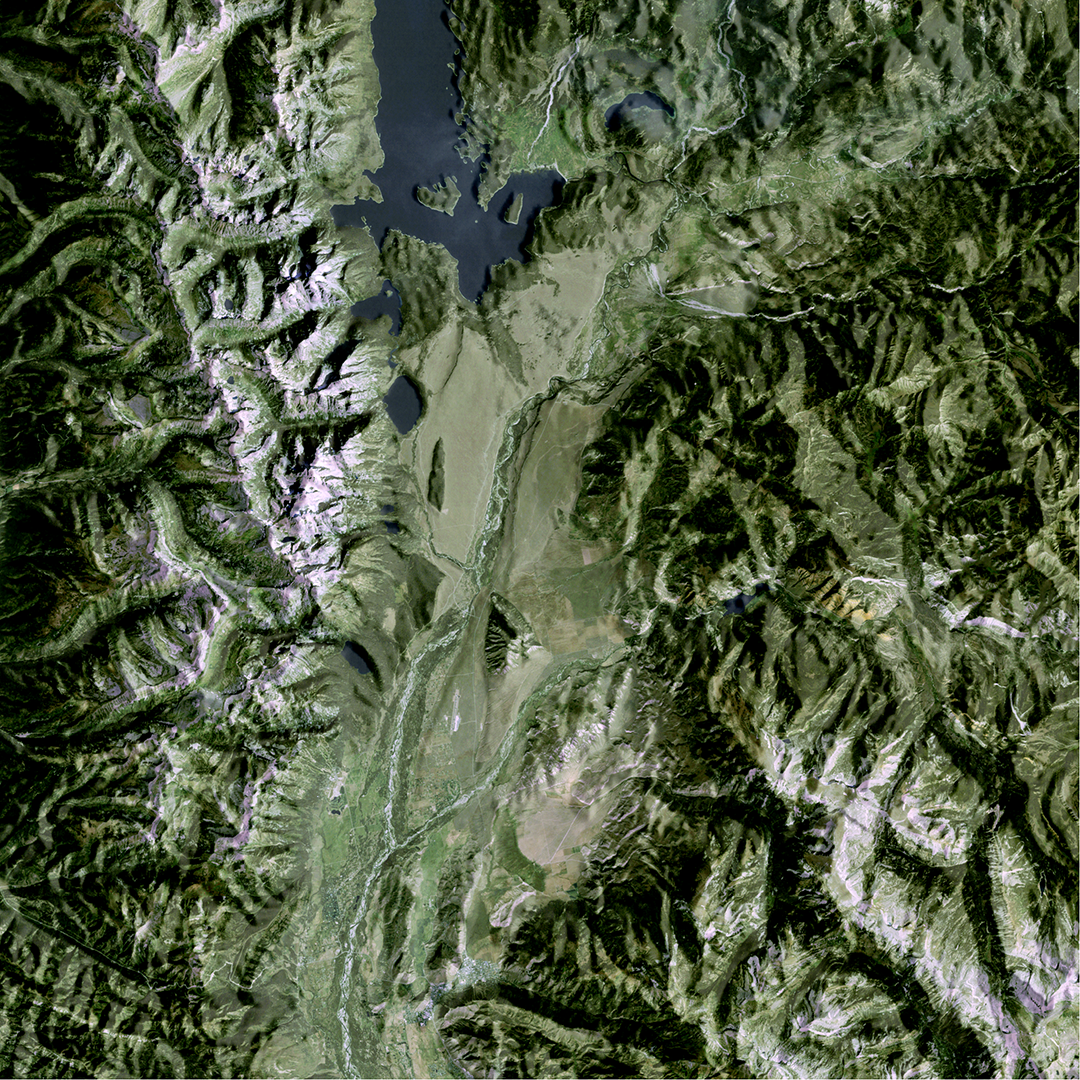
I was inspired by Tom Patterson’s work of draping satellite imagery over terrain to create this image of the Grand Tetons. I spent the summer of 2014 reacquainting myself with the U.S. after four years in Colombia by taking a road trip around the country with my family before landing in Madison, Wisconsin. Our stop in the Grand Tetons is near to my heart, where we hiked, kayaked, and enjoyed the stunning mountain scenery.
Process: I used Blender to create shaded relief and Photoshop to create a natural color image from Landsat 5 imagery. I overlaid the shaded relief with the satellite image to make the topography of the area pop.
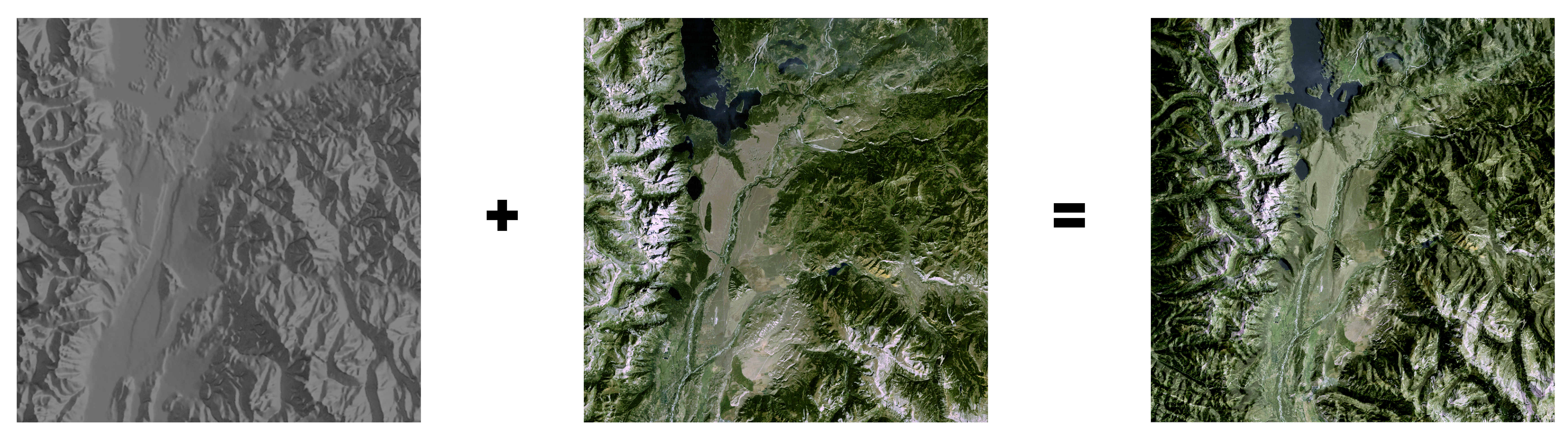
I debated how to do the shaded relief; typically, when creating relief, the “light source” should come from the top-left of the image in order for the terrain to not appear inverted. However, in the satellite image, it is morning and thus the natural sunlight appears from the right side of the image. After much trial and error, I ultimately decided for the light source to be on the right-hand side of the terrain to accentuate the actual light on the satellite image. That said, I have had one person tell me the terrain looked inverted to them!
Thanks to Daniel Huffman for your shaded relief in Photoshop and shaded relief in Blender tutorials!